HYTHE BRIDGES
- Iris Pearce

- Jun 9
- 6 min read
Updated: 7 days ago
Introduction
This page provides information about the canal bridges and their history. The content is divided into two sections: bridges that existed before the construction of the canal (pre-1804), and those built after 1804 up to the present day.
Below, you will first see an overview of the bridges with images. Click on the image to view further details, including additional photographs and historical background.
Pre-Canal Hythe (Before 1804)
Before the construction of the Royal Military Canal, Hythe was shaped by natural streams flowing down from the surrounding hills into the town and towards the haven. These open watercourses crossed roads at several points, requiring small, simple bridges such as Eastbridge, West Bridge near Red Lion Square, leading towards Chapel Street, and Shoemaker’s Bridge.
The town’s layout, roads, and early development were closely linked to these streams. Bridges were narrow and practical, often crossing muddy or sloping ground, and their positions were determined entirely by the natural flow of water.

Hythe Bridges After the Canal Up(1804 Onwards)
The Royal Military Canal features eleven bridges and the Seabrook Outfall/sluice, which have evolved from temporary military structures into permanent landmarks over the past two centuries. These crossings, spanning from Seabrook to West Hythe, serve as essential links for the local community. Click the image to view information.
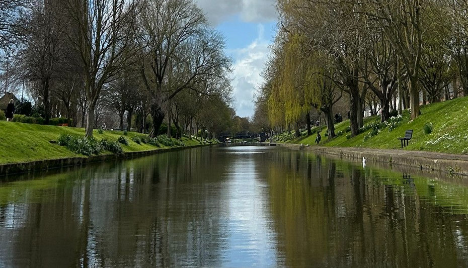
The Canal Today
Along the section of canal covered here, from Seabrook to West Hythe Bridge, a distance of approximately 7 km (4.3 miles), there are currently twelve bridges, including the Outfal /Sluice (landing stage) at Seabrook.
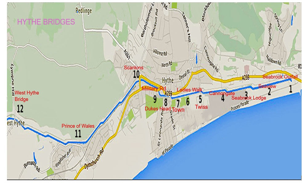
Seabrook Outfall, Seaview, Seabrook Lodge, and Cannongate Bridges
The three canal bridges mentioned currently have no signage identifying their names. In the absence of official identification, the bridges are generally known by names used locally. These names typically derive from nearby roads, buildings, or other local landmarks. Cannongate Bridge provides access onto Seabrook Road opposite Cannongate Road. Seabrook Lodge Bridge, sometimes referred to as School Bridge, took its name from the nearby Seabrook Lodge School, as referenced in the 1910 Lloyd George Survey. Sea View Bridge, also known as Sea Road Bridge, is sometimes referred to as Cliff Road Bridge. The names Cannongate Bridge, Seabrook Lodge Bridge, and Sea View Bridge are also shown on Ordnance Survey maps dating from the 1950s, indicating that these names have been in established local use for several decades.
Seabrook outfall, Sluice & landing stage

Sea View Bridge
Sea View Bridge, also known as the Sea Road/Cliff Road Bridge, provides pedestrian access between Seabrook Road (near Cliff Road) and Princes Parade, offering a direct route to the beach.

Seabrook Lodge or School Bridge
The Seabrook Lodge Bridge, also known as School Bridge, provides access to Seabrook Road and the beach.

Cannongate Bridge (also known as Tramway Bridge)
Cannongate Bridge provides access onto Seabrook Road opposite Cannongate Road and the beach.

Twiss Bridge, also known as Bell Bridge
Twiss Road Bridge, also known as Twiss Bridge, connects East Street with Princes Parade near the Imperial Hotel, providing access to and from the beach.

Pictures of Twiss Bridge


Brigadier-General William Twiss
William Twiss is remembered in Hythe as a leading military engineer who designed the town's Napoleonic War defences. He planned and oversaw the construction of the Royal Military Canal to protect against French invasion, built Fort Twiss near the seafront, and supervised local Martello towers. Today, his legacy is preserved in the town through the names of Twiss Road and Twiss Bridge

Ladies Walk Bridge
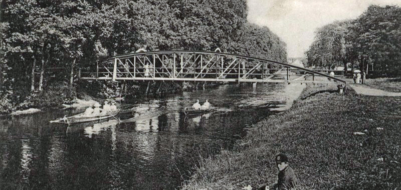
Ladies Walk Bridge is a pedestrian bridge spanning the Royal Military Canal in Hythe. It connects Prospect Road with Ladies Walk, a popular pathway that leads from the town towards the seafront. Originally known as Marine Walk, the route was laid out in the early nineteenth century and provided residents with a pleasant, traffic-free walk through the meadows to the sea. The bridge has long been an important link between the town and the coast, with several successive bridges occupying the site since 1813.

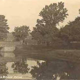
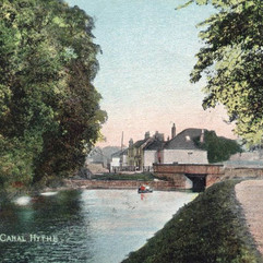
Stade Street Bridge or Town Bridge
The Town Bridge, carrying Stade Street over the Royal Military Canal, has existed in some form since at least the sixteenth century, and possibly earlier. Before the canal was built, a separate crossing known as Shoemakers Bridge stood nearby over a small stream leading towards the harbour. When the Royal Military Canal was constructed, the streams were diverted into the canal, and Shoemakers Bridge was no longer needed.
Over time, local people began associating the name Shoemakers Bridge with the Town Bridge itself, leading many to believe that there had been only one bridge. Research, however, confirms that Shoemakers Bridge and the present Town Bridge were originally two distinct crossings.
Over the years, the Town Bridge also became known as Stade Street Bridge, Nelson's Bridge, and Nelson Head Bridge. After being destroyed by a German bomb in 1940, a temporary Bailey bridge was erected. It later acquired the nickname "Rumble Bridge" because of the loud noise made by vehicles crossing it. The present bridge was completed in 1956.

Dukes Head Bridge
The Dukes Head Bridge in Hythe, Kent, is a prominent crossing point over the historic Royal Military Canal, situated where Dymchurch Road meets the canal towpath. It takes its name from the adjacent Duke's Head, a Grade II listed former coaching inn dating back to the late 18th century that permanently closed as a pub in 2016.
Click on the image for information


Military Bridge Road Bridge
The Military Road Bridge (or Musketry Bridge) is a historic, pedestrian-only, originally wooden, then Victorian to modern iron footbridge crossing the Royal Military Canal, a protected Scheduled Ancient Monument. Originally a temporary Napoleonic defensive structure, it now connects Military Road to Holman’s Field. Today, it is a vital historic lifeline that provides essential pedestrian access for local community events and vibrant seasonal festivals, seamlessly bridging its strategic wartime past with everyday community use.
Click on the image for information


Scanlon's Bridge
Scanlon Bridge, originally known as Gallows Bridge, was built during the construction of the Royal Military Canal in the early nineteenth century as part of Britain’s Napoleonic defences. After the original wooden bridge was destroyed in the storm of 1808, it was rebuilt in masonry and later became associated with anti-smuggling patrols along the canal. The bridge gained its modern name from Cornelius Scanlan, a retired soldier and Station Housekeeper who worked there in the mid-1800s. Over time, “Scanlan’s Bridge” gradually became known locally as “Scanlon Bridge.” Click image for information.

Prince of Wales Bridge (Burmarsh / Pennypot Bridge)
Pennypot Bridge, officially the Prince of Wales Bridge, is a footbridge over the Royal Military Canal in Hythe, accessed from Burmarsh Road.
The bridge was demolished in 1940 for wartime defence purposes. After the war, on 11 August 1945, Hythe Town Council discussed its reconstruction, listing it among priority canal bridges for rebuilding, with costs shared between government and local funding.
Locally, it has also been known as Pennypot Bridge and Burmarsh Bridge, and was sometimes referred to by its paint colour as the “Green Bridge” or “Grey Bridge.”


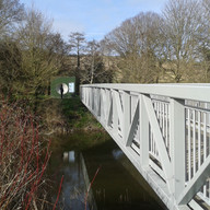


West Hythe Bridge
Introduction
West Hythe Bridge is a road and pedestrian bridge that crosses the Royal Military Canal at West Hythe in Kent. The bridge carries traffic and pedestrians between Lympne Hill and West Hythe Road, providing an important local crossing point over the canal. Although it now serves everyday transport needs, the bridge originated as part of the canal's defensive system during the Napoleonic era. Its location and design reflected its military purpose, while later developments transformed it into a civilian route and, ultimately, a historic landmark. Click on the image for information.

Thanks Iris very interesting and lots of pics I haven't seen before